Persistent flows of seawater, driven at the surface by wind and at depth by differences in density. They redistribute an enormous quantity of heat around the planet and determine the climate of many coasts.
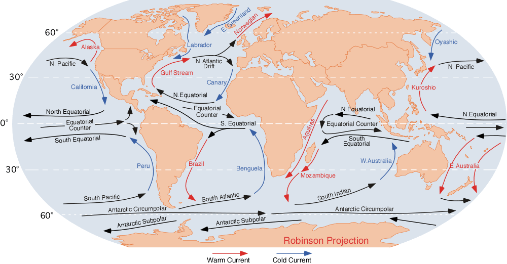
Surface currents are driven by wind, and they do not flow in the direction the wind blows.
The Earth's rotation deflects moving water, to the right in the northern hemisphere and left in the southern, which is the Coriolis effect. Combined with friction between water layers, this produces a spiral in which the net transport is at a substantial angle to the wind.
The result is a set of large rotating systems called gyres, one in each major ocean basin, turning clockwise in the north and anticlockwise in the south.
Gyres are asymmetric. Their western boundary currents, including the Gulf Stream and the Kuroshio, are narrow, fast and deep, while the return flow on the eastern side is broad and slow. This western intensification follows from the variation of the Coriolis effect with latitude.
The Gulf Stream carries a flow many times that of all the world's rivers combined, and it transports heat from the tropics into the North Atlantic.
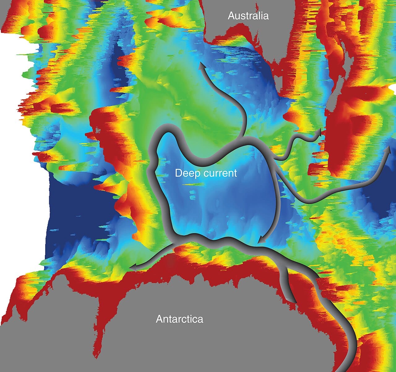
Below the wind-driven layer, circulation is driven by density, which depends on temperature and salinity. This is thermohaline circulation, treated in its own capsule.
Water becomes dense where it is cold and salty. In the North Atlantic and around Antarctica, surface water cools and, where sea ice forms, leaves its salt behind in the remaining water, making it dense enough to sink.
That sinking water spreads through the deep ocean basins and eventually returns to the surface elsewhere, completing a circulation that takes on the order of a thousand years.
The two systems are connected rather than separate, since the surface flow supplies the water that sinks and the deep flow eventually resurfaces.
Heat transport is the largest effect. The oceans carry a substantial share of the heat moved from equator to poles, comparable to the atmosphere's contribution.
The consequences for climate are direct. Northwestern Europe is markedly warmer than other places at the same latitude, and warm water transport is part of the reason, alongside the atmospheric circulation that the ocean helps sustain. Conversely, cold currents flowing toward the equator along western coasts produce cool, foggy and often arid conditions, as in California, Peru and Namibia.
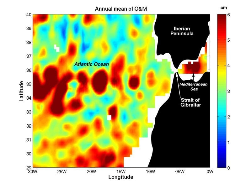
Upwelling occurs where winds push surface water away from a coast and deeper water rises to replace it. That water is cold and nutrient-rich, and the resulting productivity supports fisheries out of all proportion to the area involved. A few upwelling regions account for a large share of the global catch.
Nutrient and carbon transport follows the circulation. The ocean absorbs a substantial fraction of the carbon dioxide emitted by human activity, and currents carry it into the deep ocean where it is isolated from the atmosphere for centuries.
Currents also move organisms, including larvae and plankton, and they distribute pollution and debris, which is how floating plastic accumulates in the centres of gyres.
Direct measurement is difficult because the ocean is large, opaque to most remote sensing, and expensive to reach.
Moored instruments measure flow at fixed points, and arrays of them monitor specific currents continuously.
Drifting floats have transformed the field. The Argo programme maintains thousands of autonomous floats that drift at depth, rise periodically to record temperature and salinity, and transmit by satellite, providing global coverage that did not previously exist.
Satellite altimetry measures sea surface height very precisely, and because currents are associated with slight slopes in the surface, this reveals surface circulation globally.
Accidental releases have been used opportunistically. Cargo spills of shipping containers carrying floating goods have provided long-range drift data over years, and oceanographers have tracked them deliberately.
Warming and freshwater input from melting ice reduce the density of surface water in the North Atlantic, which is expected to weaken the deep circulation. Observations and projections of that weakening, and the disputed question of whether a rapid transition is possible, are treated in the thermohaline circulation capsule.
Warming also increases stratification, meaning the surface layer becomes more distinct from the water below, which reduces the vertical mixing that supplies nutrients to the surface and oxygen to depth.
Ocean currents are the slow component of the climate system, and they determine both the pattern of regional climate and the ocean's capacity to absorb heat and carbon.
They also demonstrate the scale of the ocean's role: the top few metres of the ocean hold as much heat as the entire atmosphere, so the circulation moving that water is moving the largest heat reservoir in the surface climate system.