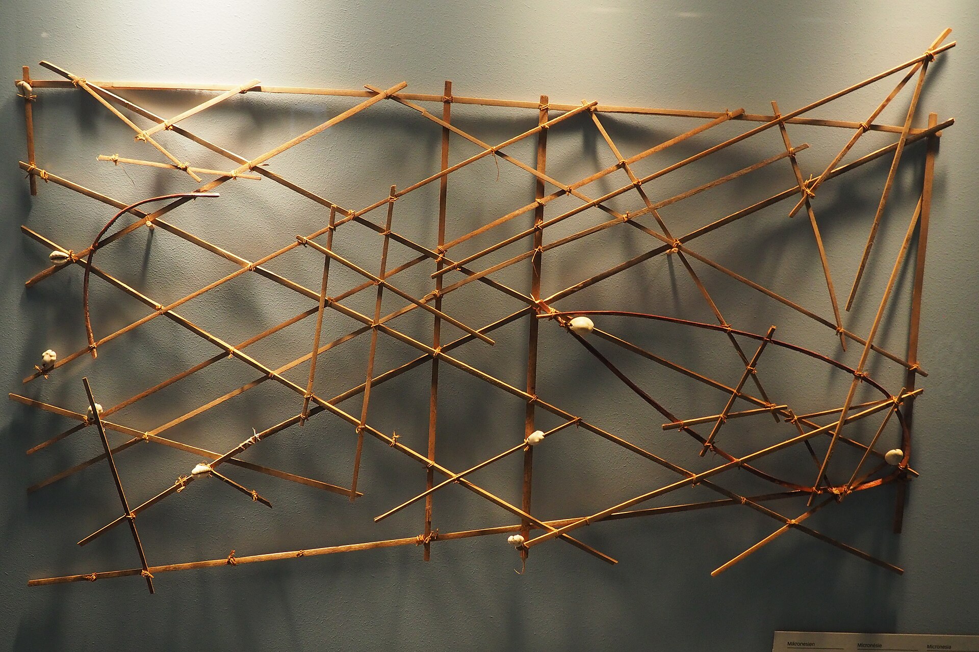
The Marshall Islands is an island nation in the central Pacific, made up of more than a thousand low-lying coral islands grouped into 29 atolls and a few isolated islands, spread across a vast area of ocean. A Micronesian nation with a remarkable seafaring heritage, its navigators once crossed the open Pacific guided by their knowledge of the swells, recorded on ingenious stick charts. In the twentieth century the islands became the site of extensive American nuclear weapons testing, whose tragic legacy still shapes the nation, which today is closely associated with the United States.
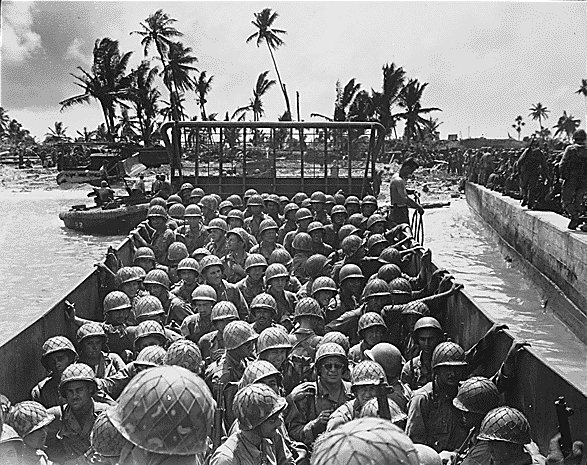
The islands were settled by Micronesian peoples some two thousand years ago, who became master navigators of the open ocean. European contact came in the sixteenth century, and the islands were named after a British explorer. Germany claimed them in the nineteenth century, Japan took them during the First World War, and the United States captured them in the Second, including the fierce Battle of Kwajalein. Under American administration the islands endured years of nuclear testing. The Marshall Islands gained self-government and, in 1986, independence in free association with the United States.
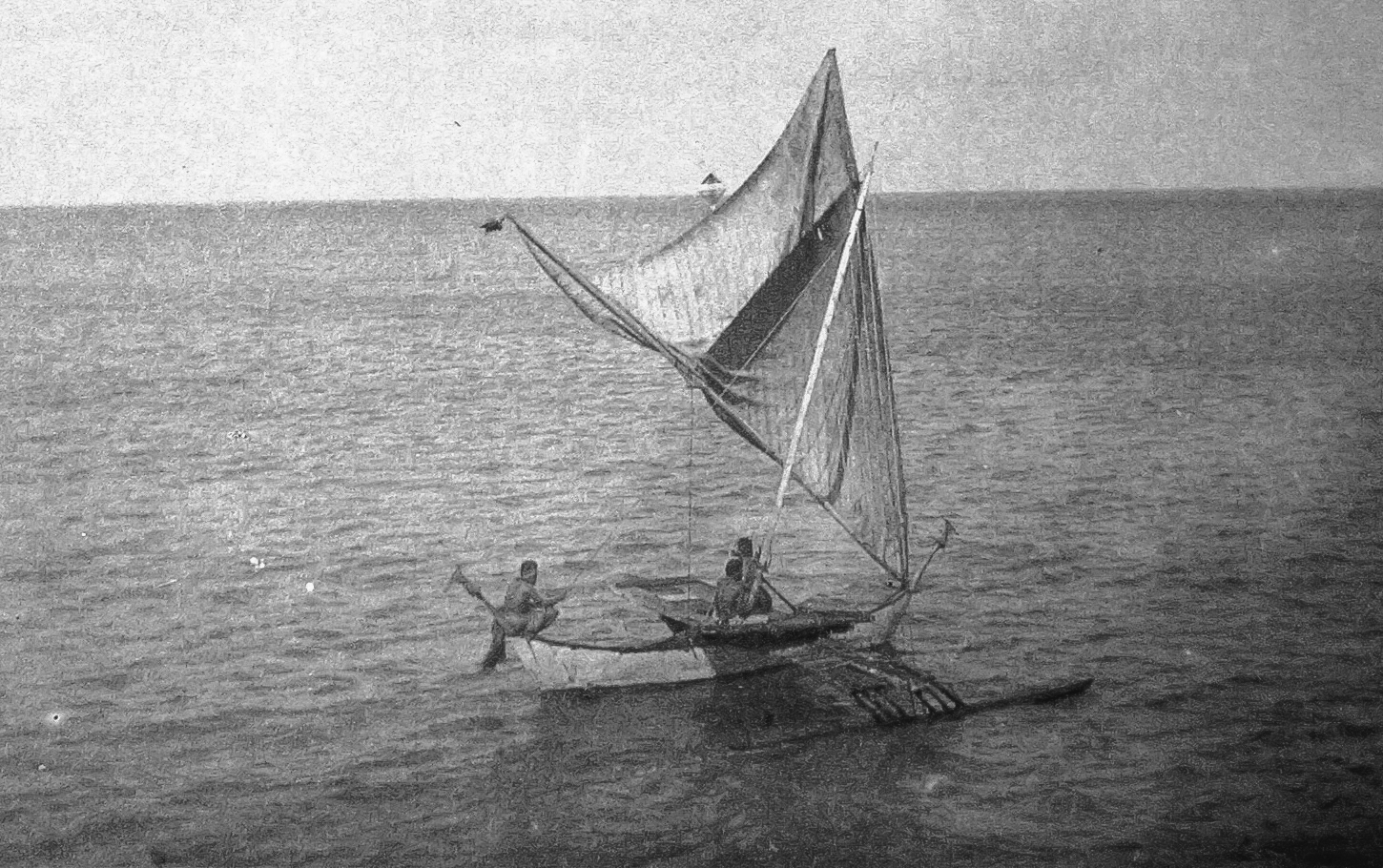
The Marshall Islands consists of more than a thousand tiny coral islands and islets gathered into 29 atolls and five isolated islands, arranged in two roughly parallel chains across the central Pacific. The islands are extremely low and flat, rarely more than a couple of metres above the sea, slender rings and strips of coral enclosing large lagoons, some among the biggest in the world, such as Kwajalein. With their minimal elevation, the islands are gravely threatened by rising sea levels and storm surges, and their scattered, watery geography has always made the ocean central to Marshallese life.
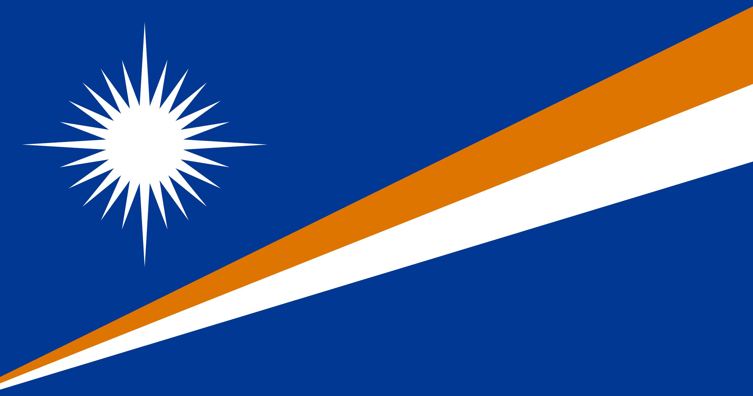
The flag of the Marshall Islands is blue, crossed diagonally from the lower hoist to the upper fly by two widening stripes of orange over white, with a large white star of many points in the upper hoist. The blue represents the Pacific Ocean, and the rising diagonal stripes the equator, with the white star above marking the islands' position in the northern hemisphere; the orange stands for courage and the white for peace. The star's many rays represent the country's electoral districts, with longer rays for the principal cultural centres.
The Marshall Islands is overwhelmingly Christian, the result of nineteenth-century missionary work, with the population belonging mainly to Protestant churches, especially a Congregationalist tradition, alongside Roman Catholic, Latter-day Saint, and other communities. The church is central to Marshallese community life, and Christianity is deeply woven into the culture and the calendar of the atolls. Traditional beliefs, customs, and the authority of chiefs persist alongside the Christian faith, in a society that blends its ancient island heritage with the now dominant religion.
Marshallese cuisine is based on the produce of the atolls and the sea. Fish and other seafood, abundant in the lagoons and surrounding ocean, are the dietary staple, along with coconut in all its forms, breadfruit, pandanus, taro, and arrowroot. Coconut and its cream flavour many dishes, and food is traditionally cooked in earth ovens. As elsewhere in the low Pacific, the limited land for farming makes the ocean and the coconut palm central to the diet, which in modern times has come to rely heavily on imported rice and tinned and processed foods.
Agriculture is constrained by the poor coral soils and tiny land area of the atolls, and the Marshall Islands grows little for export beyond coconuts, processed into copra, which has long been the main cash crop. Breadfruit, pandanus, taro, and arrowroot are grown for local use, and pigs and poultry are kept. The economy depends far more on the sea, through fishing and the licensing of its waters to foreign tuna fleets, and on financial support and payments from the United States under the compact of free association, as well as the lease of land for an American missile testing range at Kwajalein.
The settlement of the islands and the flowering of their extraordinary navigation tradition, the colonial era, and the Battle of Kwajalein shaped the Marshall Islands, but the most fateful chapter was the era of American nuclear testing. Between 1946 and 1958 the United States detonated dozens of nuclear weapons at Bikini and Enewetak atolls, including the enormous Castle Bravo test, exposing islanders to radiation, displacing communities, and leaving a legacy of contamination, illness, and exile that the nation still struggles with today. Independence in free association with the United States came in 1986.
The Marshall Islands has a population of around 40,000 people, predominantly the Micronesian Marshallese, sharing the Marshallese language alongside English. The population is concentrated on a few atolls, above all the crowded capital, Majuro, and the urban area near the American base at Kwajalein, while many outer atolls remain sparsely settled. Society retains a traditional structure of clans and chiefs, organised around the extended family and the land, which passes through the mother's line. A very large number of Marshallese have emigrated to the United States, which the compact allows them to enter and work in freely.