Eritrea is a country in the Horn of Africa, on the Red Sea coast, with a long shoreline and a string of islands facing one of the world's busiest shipping lanes. A land of ancient history at the crossroads of Africa and Arabia, it was home to early Christian and Islamic communities and, more recently, to a remarkable thirty-year war for independence. Since winning that freedom, it has become one of the most isolated and tightly controlled states in the world.
Eritrea's history is very old and its statehood is very new. The highlands were part of one of the ancient world's significant civilisations, the coast was among the first places outside Arabia to hear Islam, and the country itself has existed only since 1993, won by one of the longest wars of independence anywhere.
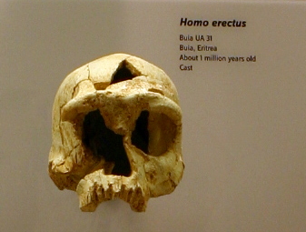
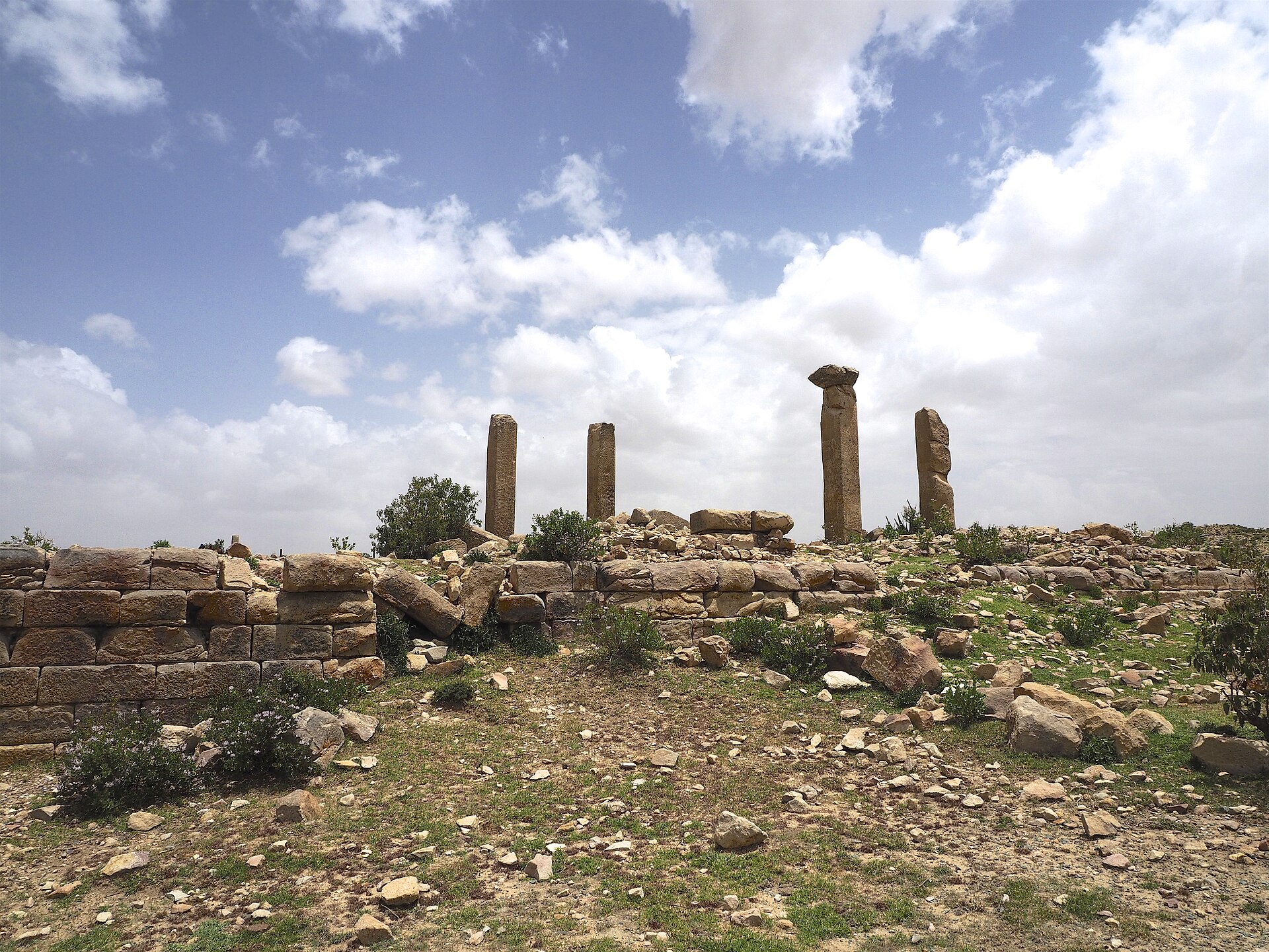
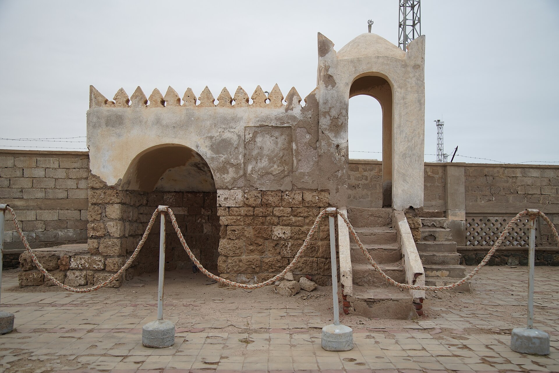
The Danakil and the surrounding region have yielded hominin remains of great antiquity, including the Buia skull, roughly a million years old, which sits close to the transition between Homo erectus and later forms. In historical times the highlands lay within the orbit of Dmt and then Aksum, the trading empire that minted its own coinage, controlled the Red Sea commerce between Rome and India, and in the fourth century became one of the earliest states anywhere to adopt Christianity. The ruined city of Qohaito, with its standing columns, is among the sites of that world. In the seventh century, when the first Muslims were persecuted in Mecca, the Prophet directed a group of them to seek refuge across the sea in the Christian kingdom, and the mosque at Massawa is held by tradition to date from that period, making the Eritrean coast one of the earliest points of contact between Islam and Africa.
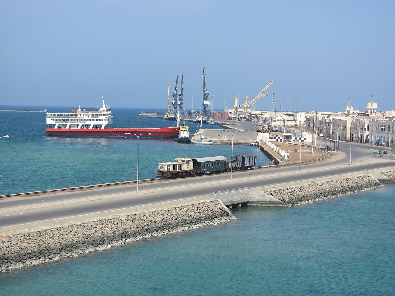
The coast passed through Ottoman and then Egyptian hands, while the highlands were contested between local rulers and the Ethiopian emperors. Italy bought the port of Assab in 1869, took Massawa in 1885, and in 1890 proclaimed the colony of Eritrea, naming it for the Greek term for the Red Sea. It was Italy's first colony and its main African possession, and it received substantial investment: a railway climbing from the coast to the highlands, a cableway, and above all Asmara, which Italian architects rebuilt in the 1930s as a laboratory of modernist and futurist design so complete that the whole city centre is now a UNESCO World Heritage site. It was also a colony, with racial segregation in law and Eritreans conscripted as askari troops for Italy's wars, including the invasion of Ethiopia in 1935.
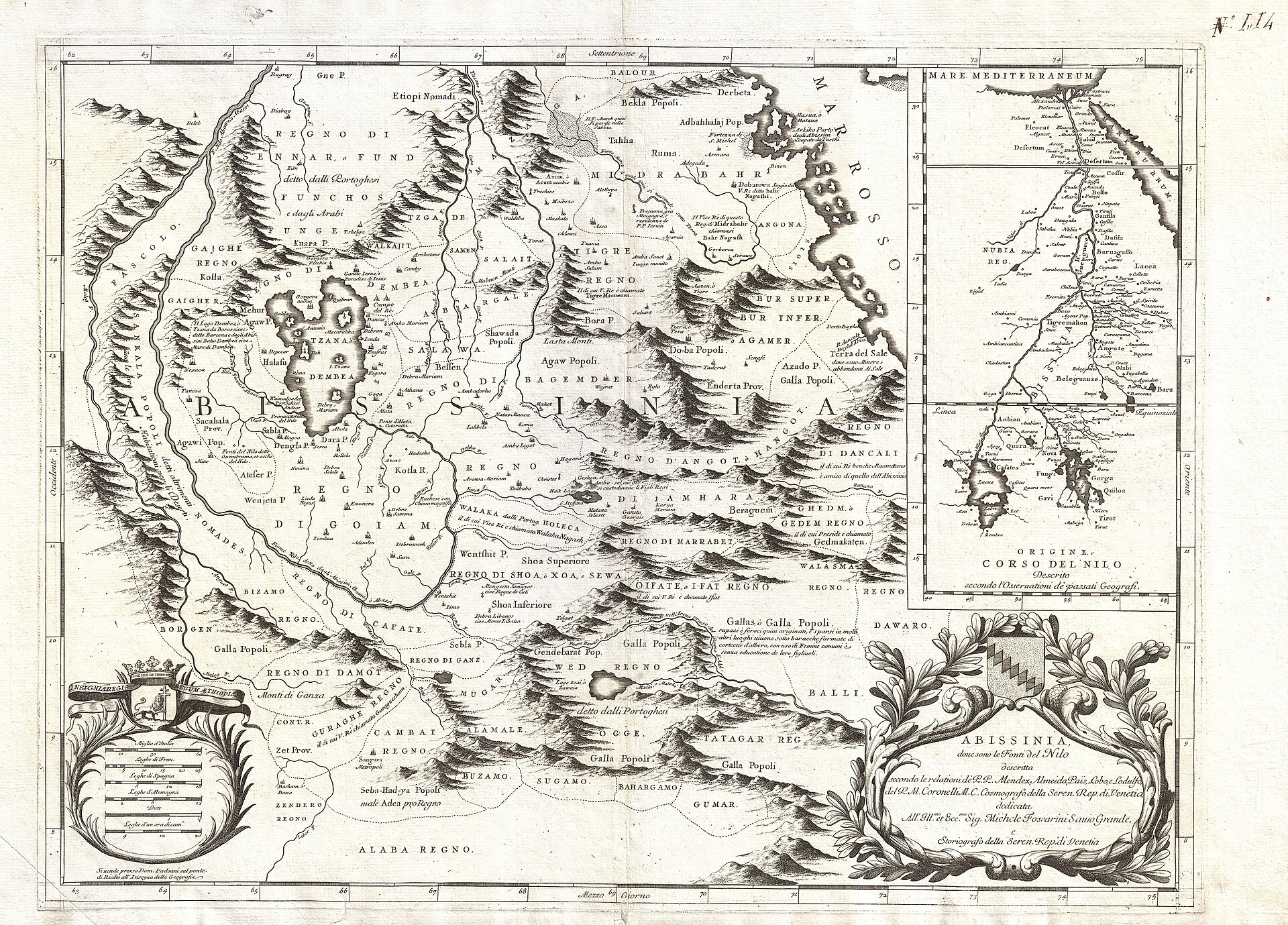
Britain took Eritrea from Italy in 1941 and administered it for a decade. In 1952 the United Nations resolved the territory's future by federating it with Ethiopia, giving Eritrea its own parliament, flag, and languages under the Ethiopian crown. Emperor Haile Selassie dismantled that autonomy piece by piece, banning political parties and the Tigrinya and Arabic languages, and in 1962 dissolved the Eritrean assembly and annexed the territory outright.
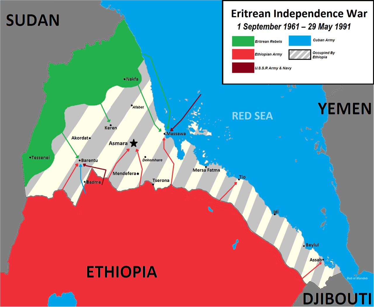
Armed resistance had begun in 1961 and lasted thirty years, through the emperor's fall and the Marxist Derg regime that replaced him and fought the war with Soviet backing. The Eritrean People's Liberation Front, which came to dominate the struggle, built something unusual: an underground society in the liberated areas with its own schools, hospitals, printing presses, and workshops carved into the hills, a high proportion of women among its fighters, and a fierce doctrine of self-reliance. In 1991, in alliance with Ethiopian rebels who took Addis Ababa, the EPLF captured Asmara. A referendum in 1993 recorded an overwhelming vote for independence, and Eritrea became a state, with the EPLF's leader, Isaias Afwerki, at its head.
Hopes of a new beginning did not survive the decade. In 1998 a dispute over the border town of Badme escalated into a conventional war with Ethiopia, fought with trenches and artillery, in which perhaps a hundred thousand people died on both sides over two years. A boundary commission awarded Badme to Eritrea in 2002; Ethiopia did not implement the ruling, and the two countries settled into a frozen confrontation of no war and no peace. Eritrea's government used that standing emergency to justify indefinite national service, the postponement of the constitution ratified in 1997, and the suspension of the elections that were to follow. In 2001 a group of senior officials and journalists who called publicly for reform were arrested; most have not been seen since.
In 2018 Ethiopia's new prime minister, Abiy Ahmed, accepted the boundary ruling, and the two leaders signed a peace declaration, an act for which Abiy received the Nobel Peace Prize. Eritrean forces later fought alongside the Ethiopian federal army in the Tigray war between 2020 and 2022, and were accused by United Nations investigators of massacres, sexual violence, and looting, which Eritrea denies. The rapprochement has since collapsed. Ethiopia, landlocked since Eritrean independence, has pressed publicly for access to the sea and specifically to the port of Assab; through late 2025 and into 2026 each government accused the other of preparing for war, with Isaias saying Ethiopia had declared war on his country and Eritrea's information minister describing Ethiopian claims as a pretext for invasion. No fighting had begun as of mid-2026, and the risk of a fresh regional conflict is widely assessed as serious.
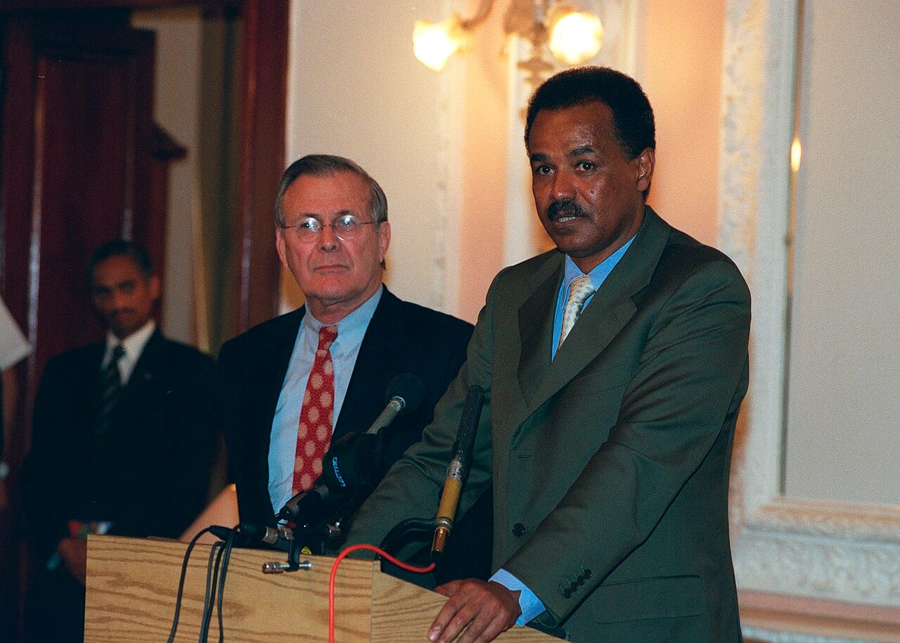
Eritrea is a one-party state under the People's Front for Democracy and Justice, the successor to the liberation front, and it has been led by Isaias Afwerki without interruption since 1993. It is the only country in Africa never to have held a national election. The constitution ratified in 1997 has never been implemented, there is no national legislature in session, no independent judiciary, and no privately owned media of any kind; Eritrea has ranked at or near the bottom of international press freedom indices for many years, alongside North Korea.
The central institution of the state is national service. Legally set at eighteen months, it has in practice been extended indefinitely since the border war, so that conscripts, both men and women, may serve for many years at token pay in the army or in state agriculture, construction, and administration. United Nations investigators have described the system as amounting to forced labour and, in a 2016 commission of inquiry, as constituting crimes against humanity. The Eritrean government rejects those findings, argues that the country faces a genuine existential threat from a far larger neighbour that has not renounced its claims, and points to its record on health indicators and on the absence of the ethnic and religious conflict that has torn its neighbours apart.
The consequence that is not disputed is emigration. Eritreans have for two decades been among the largest national groups attempting the crossing to Europe relative to population, and hundreds of thousands live as refugees in Ethiopia, Sudan, and beyond. The country's population figures are correspondingly uncertain, since no census has been conducted.
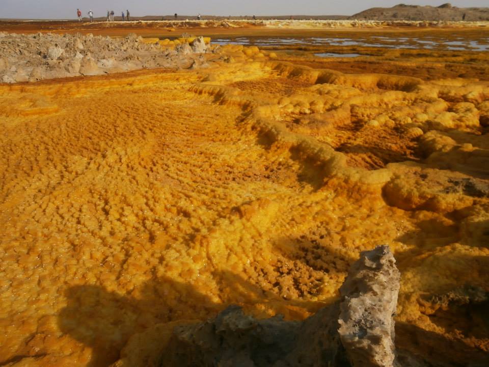
Eritrea has three distinct zones. Along the Red Sea runs a hot, arid coastal plain, which at its southern end drops into the Danakil Depression, one of the hottest inhabited places on Earth and one of the lowest points in Africa, a landscape of salt flats, sulphur springs, and active volcanoes formed where three tectonic plates are pulling apart. Inland the land rises sharply to a central highland plateau above two thousand metres, temperate and cultivable, where Asmara sits and most Eritreans live. West of the highlands the country falls away again into the hotter lowlands toward Sudan.
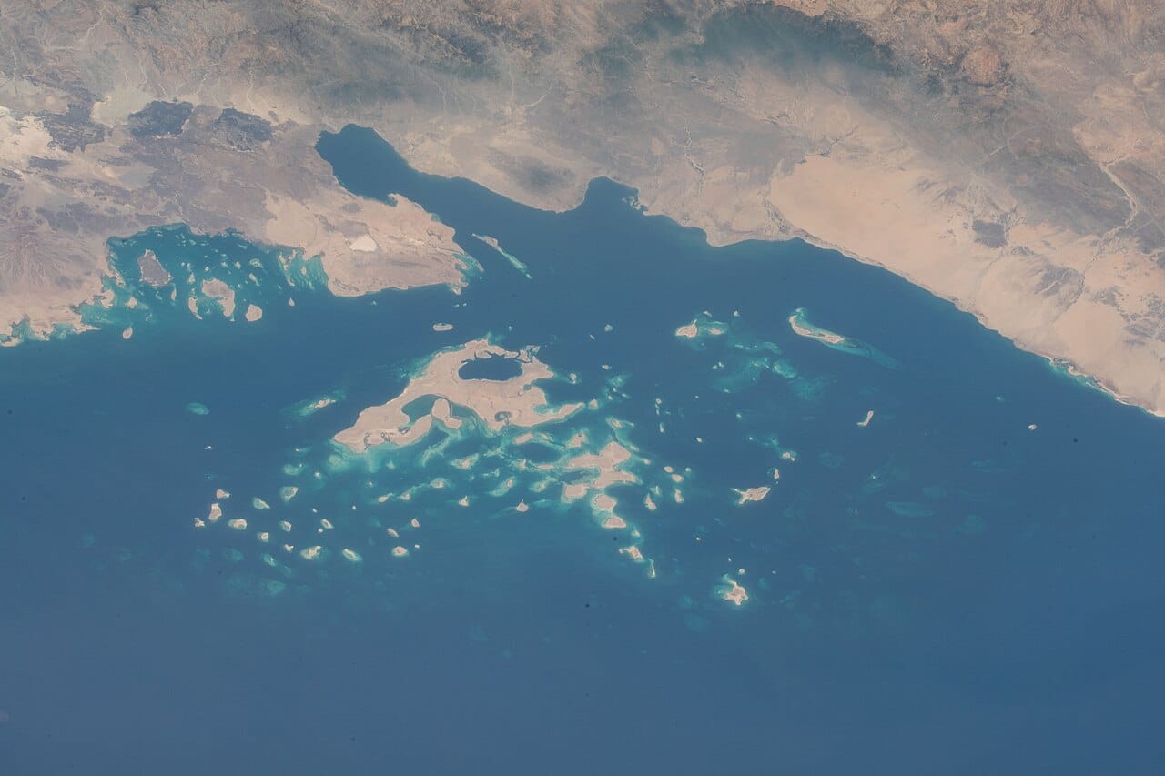
The coastline runs more than a thousand kilometres and faces the Bab el-Mandeb approaches, and offshore lie the roughly two hundred islands of the Dahlak Archipelago, with coral reefs that are among the least disturbed in the Red Sea, in part because so little development has reached them. Rainfall is unreliable and drought recurrent, and deforestation over the past century has been severe, prompting a long-running national tree-planting effort.
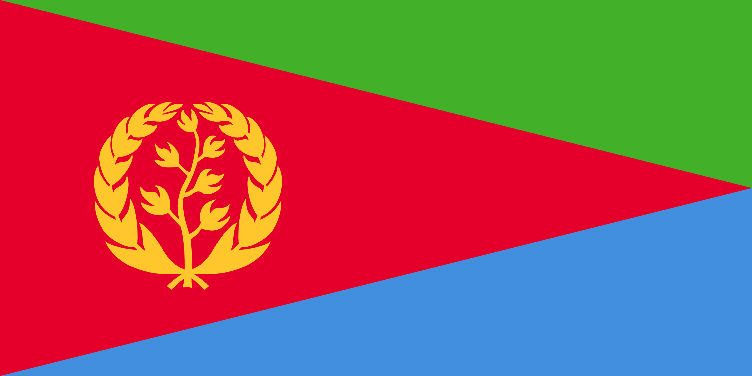
The flag of Eritrea has a red triangle based on the hoist, dividing a green triangle above from a blue one below, with a golden emblem of an olive branch and wreath in the red. The red represents the blood shed in the long struggle for independence, the green the country's agriculture and fertility, and the blue the wealth of the Red Sea. The olive wreath, carried over from an earlier independence-era flag, symbolises peace and the hope of the nation.
Eritrea's population is split almost evenly between Christianity and Islam, a reflection of its position at a crossroads of faiths. The Christians belong mainly to the ancient Eritrean Orthodox Church, related to the Ethiopian tradition and reaching back to the early centuries of the faith, along with Catholics and Protestants, while the Muslims are predominantly Sunni, Islam having reached the Red Sea coast in the earliest days of the religion. The state recognises only a limited number of religious bodies and tightly controls religious life.
Eritrean cuisine is closely related to that of Ethiopia, centred on injera, a large, spongy sourdough flatbread, here often made from sorghum or wheat as well as the tiny grain teff, which serves as both plate and utensil. Onto it are spooned spicy stews of meat, lentils, and vegetables, seasoned with the rich regional spice blends, with plenty eaten during religious fasts. The Italian colonial legacy also left a love of pasta and espresso-style coffee, woven into the food culture.
Agriculture is the livelihood of most Eritreans, despite frequent drought and a harsh environment. Farmers in the highlands grow sorghum, barley, wheat, and teff, along with vegetables and fruit, while in the lowlands herding of cattle, goats, sheep, and camels is important. The country has potential in fishing along its long Red Sea coast and in mining, with significant deposits of gold and other minerals. Recurring drought and the demands of the state, however, weigh heavily on rural life.
Eritrean culture is layered from the same sources as its history: the Orthodox Christian and Muslim traditions of the highlands and coast, the pastoral cultures of the lowlands, and a distinct Italian residue that shows up in the coffee, the pastries, and the architecture. Coffee is served in a ceremony of roasting, grinding, and three successive pourings that can take an hour and is a social obligation as much as a drink. Music centres on the krar lyre and the wata fiddle, and the guayla circle dance is the fixture of every wedding.
The country's most remarkable single artefact is Asmara itself. Rebuilt by Italian architects in the 1930s in rationalist, futurist, and art deco idioms, and then largely frozen by decades of poverty and isolation, it survives as the most complete modernist city anywhere, with its cinemas, filling stations, and apartment blocks intact; UNESCO inscribed it in 2017. National identity is strongly marked by the war of independence, which is commemorated intensively and which supplies the state's founding legitimacy, and by a diaspora that sustains the country financially and argues about it fiercely from outside.
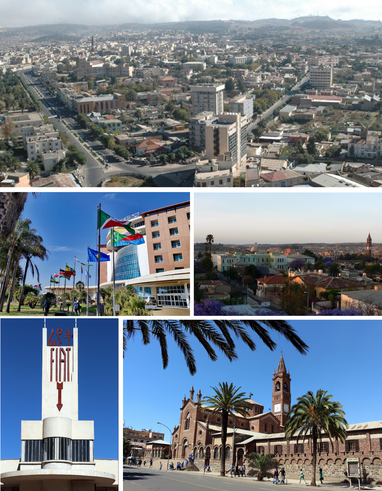
Eritrea's population is estimated at somewhere around 3.5 million, though no census has ever been taken and the figures are correspondingly uncertain. There are nine recognised ethnic groups: the Tigrinya of the highlands, who are the largest, the Tigre of the northern lowlands, and the Saho, Afar, Bilen, Kunama, Nara, Hedareb, and Rashaida. The population is divided roughly evenly between Christians, mostly Eritrean Orthodox with Catholic and Protestant minorities, and Sunni Muslims, and the split broadly follows the geography, with Christians concentrated in the highlands and Muslims in the lowlands and along the coast. Tigrinya and Arabic serve as working languages alongside English, which is the medium of secondary education; the state has deliberately avoided declaring a single official language.
Most Eritreans live in the highlands, above all in Asmara. Set against the resident population is an exceptionally large diaspora, built by successive waves of departure during the war of independence, after the border war, and continuously since, whose remittances are among the country's most important sources of foreign currency.